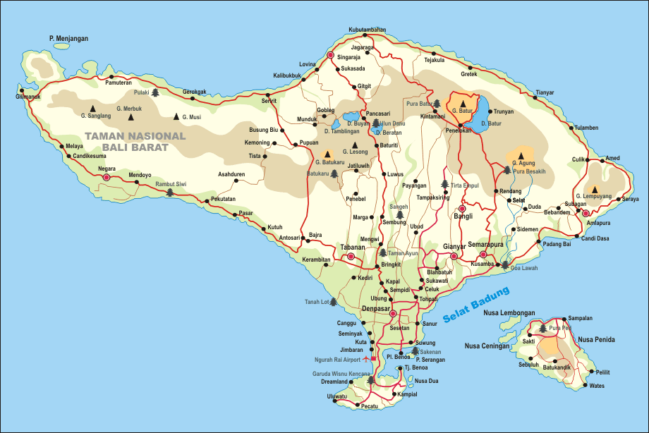
The island of Bali is part of the Republic of Indonesia. In addition to Bali, Indonesia comprises more than 17,000 islands, of which 6,000 are inhabited.
Indonesia is the largest archipelagic state in the world.
The island of Bali is situated at 8 degrees south of the equator in the southern hemisphere, meaning it is almost directly on the equator.
Near the island of Bali is one of the major islands of Indonesia - Java, with the capital Jakarta.
The capital of Bali is the city of Denpasar, located in the south of the island. The population of the city is approximately 700 thousand people.

The city is very densely built. Mostly, Balinese and Indonesians live there. There are few tourist attractions in Denpasar, mostly a couple of museums and several temples. The traffic is very heavy, and it's not recommended to go there unless absolutely necessary.
One of the districts that administratively belongs to Denpasar, Sanur, is usually considered a separate area from a cultural and infrastructural point of view. This is the tourist part of Denpasar, located by the ocean.
Sanur is one of the oldest tourist areas in Bali. It is preferred by families with children and older individuals. In Sanur, it is very convenient to walk everywhere and ride bicycles.
To reach Bali, one travels by plane to the Ngurah Rai International Airport, located in the Kuta area.
The area of the island of Bali is approximately 5,800 square kilometers (150 kilometers in length and 80 kilometers in width). The population is 4.22 million people.
The island boasts diverse flora and fauna. Additionally, the island looks entirely different in its various parts. A significant contrast can be observed, especially between coastal areas with equatorial vegetation and highland regions.
Interestingly, Bali is a Hindu island in predominantly Muslim Indonesia. Read more about religion in Bali.
You can add one right now!